[?]Subscribete a esta paginas web


|
Arizona County Map Arizona County Map 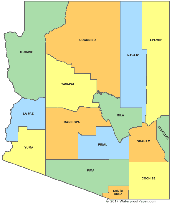 Map Courtesy of Digital Map Store Arizona has 15 counties. Its biggest county is Coconino with an area of 18,562 square miles and the smallest is Santa Cruz county with an area of 1,238 square miles. English United States Flag | United States Map | USA States Names | USA States and Capitals | USA States Abbreviations | United States Currency | Flag of Arizona Español Bandera Americana | Estados Unidos Mapa | Moneda de USA Sources http://quickfacts.census.gov/qfd/states/04/04013.html
Return from Arizona County Map to facts about Arizona
|


Medford, Oregon, United States

Central Point, Oregon, United States

Grants Pass, Oregon, United States

Crater Lake National Park, Oregon, United States