[?]Subscribete a esta paginas web


|
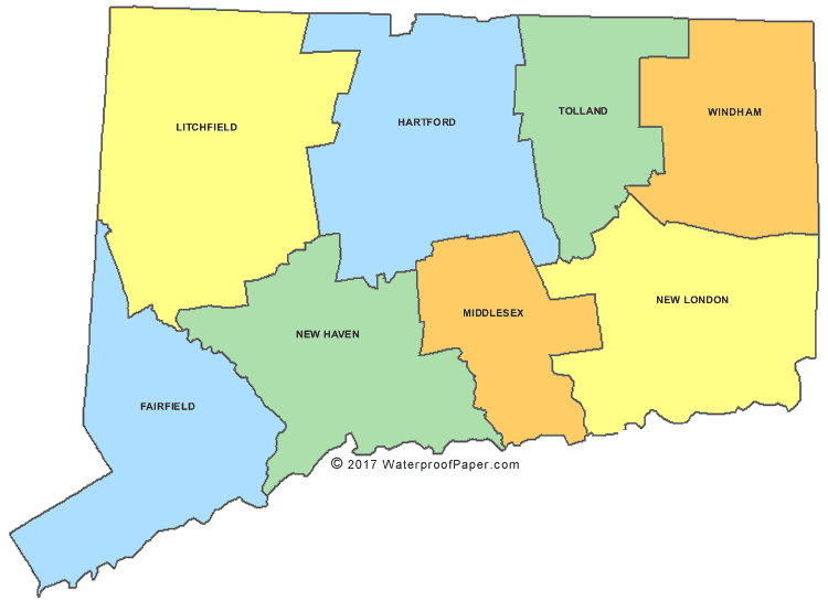
Connecticut County MapConnecticut County Map Connecticut has only 8 counties and its capital city is Hartford; its largest city is Bridgeport. Connecticut covers and area of 5,544 square miles which makes it the 48th largest state in the United States. Connecticut is bordered by the states of Massachusetts, New York, Rhode Island and also by the bodies of water of Long Island Sound and the Atlantic Ocean. English United States Flag | United States Map | USA States Names | USA States and Capitals | USA States Abbreviations | United States Currency Español Bandera Americana | Estados Unidos Mapa | Moneda de USA
Return from Connecticut County Map Facts about Connecticut
|


Medford, Oregon, United States
Central Point, Oregon, United States

Grants Pass, Oregon, United States

Crater Lake National Park, Oregon, United States