[?]Subscribete a esta paginas web


|
Idaho County MapIdaho County Map 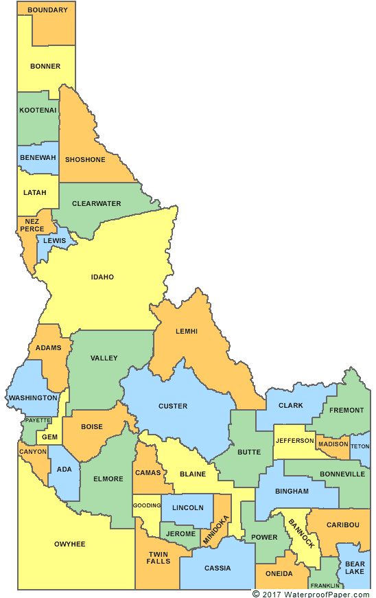 Idaho is one of the 50 states that form the United States. The state of Idaho has 44 counties. Idaho county is the largest County; it has an area of 8503 square miles while Payette County is the smallest with an area of 403 square miles. English United States Flag | United States Map | USA States Names | USA States and Capitals | USA States Abbreviations | United States Currency Español Bandera Americana | Estados Unidos Mapa | Moneda de USA Sources http://www.idahocounty.org/ Other keyword used are idaho counties map, county idaho map, maps id, and id map.
Return from Idaho County Map to Facts about Idaho
|


Medford, Oregon, United States
Central Point, Oregon, United States

Grants Pass, Oregon, United States

Crater Lake National Park, Oregon, United States