


|
Cuba Map
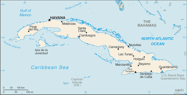
Cuba is located in the Caribbean. It is an island between the Caribbean Sea and the North Atlantic Ocean, 150 kilometers south of Key West, Florida. The capital of Cuba is Havana. Cuba is divided in 14 provinces and 1 special municipality*; Camaguey, Ciego de Avila, Cienfuegos, Ciudad de La Habana, Granma, Guantanamo, Holguin, Isla de la Juventud*, La Habana, Las Tunas, Matanzas, Pinar del Rio, Sancti Spiritus, Santiago de Cuba, and Villa Clara Other tags used are map of Cuba, maps Cuba, and map Cuba.
Return from Cuba map to facts about Cuba
|


Medford, Oregon, United States

Central Point, Oregon, United States

Grants Pass, Oregon, United States

Crater Lake National Park, Oregon, United States