|
|
Peru Map
Peru Flag Bandera de Peru Mapa de Peru
Peru Map
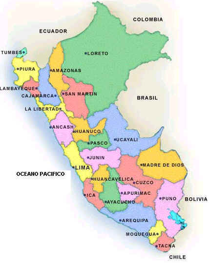
Peru is located in Western South America, bordering the South Pacific Ocean, between Chile and Ecuador. Its borders are with Bolivia, Brazil, Chile, Colombia, and Ecuador.Peru has 25 regions and 1 province*
Amazonas, Ancash, Apurimac, Arequipa, Ayacucho, Cajamarca, Callao, Cusco, Huancavelica, Huanuco, Ica, Junin, La Libertad, Lambayeque, Lima, Lima*, Loreto, Madre de Dios, Moquegua, Pasco,Piura, Puno, San Martin, Tacna, Tumbes, and Ucayali
Sources
https://www.cia.gov/library/publications/the-world-factbook/flags/flagtemplate_pe.html
http://www.sitographics.com/enciclog/banderas/america/source/28.html
https://www.cia.gov/library/publications/the-world-factbook/geos/pe.html
Other keywords used are map of Peru, maps Peru, and map Peru.
Return from peru map to facts about peru
Return to the home page
Enjoy this page? Please pay it forward. Here's how...
Would you prefer to share this page with others by linking to it?
- Click on the HTML link code below.
- Copy and paste it, adding a note of your own, into your blog, a Web page, forums, a blog comment,
your Facebook account, or anywhere that someone would find this page valuable.
|
|
Make Money with Clickbank
Medford, Oregon, United States
Central Point, Oregon, United States
Grants Pass, Oregon, United States
Crater Lake National Park, Oregon, United States
|


