[?]Subscribete a esta paginas web


|
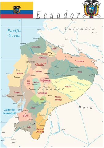
Ecuador MapEcuador is located in Western South America, bordering the Pacific Ocean at the Equator, between Colombia and Peru. Ecuador has 24 provinces (provincias, singular - provincia); Azuay, Bolivar, Canar, Carchi, Chimborazo, Cotopaxi, El Oro, Esmeraldas, Galapagos, Guayas, Imbabura, Loja, Los Rios, Manabi, Morona-Santiago, Napo, Orellana, Pastaza, Pichincha, Santa Elena, Santo Domingo de los Tsachilas, Sucumbios, Tungurahua, Zamora-Chinchipe
Return from ecuador map to facts about ecuador
|


Medford, Oregon, United States

Central Point, Oregon, United States

Grants Pass, Oregon, United States

Crater Lake National Park, Oregon, United States