[?]Subscribete a esta paginas web


|
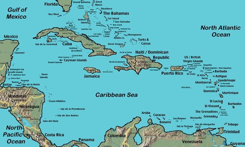
Caribbean Map
English Caribbean Countries Español Paises del Caribe Mapa del Caribe As you can see on the map, Cuba is the largest country island followed by the island that has the countries of Haiti and Dominican Republic. Jamaica and Puerto Rico are about the same size. Please visit the individual countries for its land size. There are numerous Caribbean islands all over the place and I will do my best to list those under each country to which they belong. Other tags used are the Caribbean islands map, map of the and Caribbean islands,
Return from Caribbean map to Caribbean countries
|


Medford, Oregon, United States

Central Point, Oregon, United States

Grants Pass, Oregon, United States

Crater Lake National Park, Oregon, United States