


|
Bahamas Map
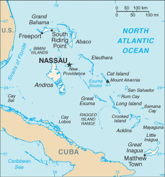
The Bahamas are a chain of islands (about 700 of them) located in the Caribbean in the North Atlantic Ocean, southeast of Florida, northeast of Cuba. The Bahamas are located about 50 miles off the East Coast of Florida. The Bahamas have 21 districts; Acklins and Crooked Islands, Bimini, Cat Island, Exuma, Freeport, Fresh Creek, Governor's Harbour, Green Turtle Cay, Harbour Island, High Rock, Inagua, Kemps Bay, Long Island, Marsh Harbour, Mayaguana, New Providence, Nichollstown and Berry Islands, Ragged Island, Rock Sound, Sandy Point, San Salvador, and Rum Cay. Other tags used are maps of Bahamas, map Bahamas, and map Bahama.
Return from Bahamas map to facts about Bahamas
|


Medford, Oregon, United States

Central Point, Oregon, United States

Grants Pass, Oregon, United States

Crater Lake National Park, Oregon, United States