[?]Subscribete a esta paginas web


|
Guatemala Map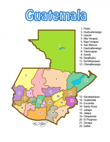 Guatemalan Map Guatemalan Flag Bandera de Guatemala Guatemala Map Guatemala is one of the five countries of Central America. Its borders are with the North Pacific Ocean, between El Salvador and Mexico, and bordering the Gulf of Honduras (Caribbean Sea) between Honduras and Belize. Guatemala has 22 departments and they are: 2. Baja Verapaz 3. Chimaltenango 4. Chiquimula 5. Petén 6. El Progreso 7. Quiché 8. Escuintla 9. Guatemala 10. Huehuetenango 11. Izabal 12. Jalapa 13. Jutiapa 14. Quetzaltenango 15. Retalhuleu 16. Sacatepéquez 17. San Marcos 18. Santa Rosa 19. Sololá 20. Suchitepéquez 21. Totonicapán 22. Zacapa Sources http://www.oas.org/children/maps/guatemala_map.html https://www.cia.gov/library/publications/the-world-factbook/geos/gt.html http://geology.com/world/colombia-satellite-image.shtml Other tags used are map of guatemala, map guatemala, maps guatemala.
Return from guatemala map to facts about guatemala
|


Medford, Oregon, United States

Central Point, Oregon, United States

Grants Pass, Oregon, United States

Crater Lake National Park, Oregon, United States