|
|
Costa Rica Map
Mapa Costa Rica Costa Rican Flag Costa Rica Bandera
Costa Rica Map
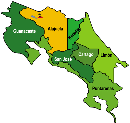
Costa Rica is one of the five countries that make Central America, bordering both the Caribbean Sea and the North Pacific Ocean, between Nicaragua and Panama.Costa Rica land divisions are called provinces and they are:
San Jose
Alajuela
Heredia
Guanacaste
Cartago
Puntarenas
Limon Its major Cities are:
San José, Puerto Limón, San Francisco, Alajuela, Liberia, Paraíso, Puntarenas, San Isidro, Curridabat, y San Vicente.
Sources
https://www.cia.gov/library/publications/the-world-factbook/geos/cs.html
http://www.geonames.org/CR/largest-cities-in-costa-rica.html Other tags used are map of Costa Rica, and map Costa Rica
Return from costa rica map to costa rica facts
Return to the home page
Enjoy this page? Please pay it forward. Here's how...
Would you prefer to share this page with others by linking to it?
- Click on the HTML link code below.
- Copy and paste it, adding a note of your own, into your blog, a Web page, forums, a blog comment,
your Facebook account, or anywhere that someone would find this page valuable.
|
|
Make Money with Clickbank
Medford, Oregon, United States
Central Point, Oregon, United States
Grants Pass, Oregon, United States
Crater Lake National Park, Oregon, United States
|


