California County Map


California County Map


California County Map


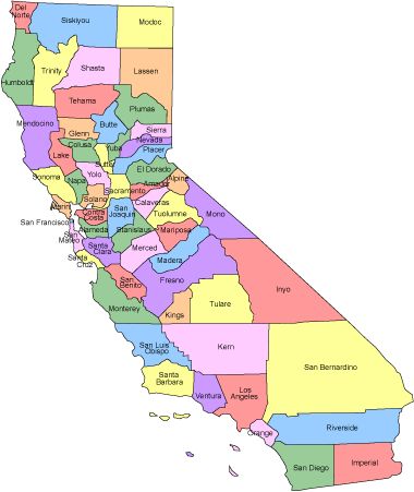
California is the 3rd largest state of the United states covering an area of 163,707 square miles. Its capital city is Sacramento and its largest city is Los Angeles. California has 58 Counties and San Bernardino county being the largest one.

California State Counties

English
United States Flag | United States Map | USA States Names | USA States and Capitals | USA States Abbreviations | United States Currency

Español
Bandera Americana | Estados Unidos Mapa | Moneda de USA


Other keywords used are county map california, california counties map, ca county map, and ca county maps.


Return from California County Map to facts about California

Return to United States Facts


Enjoy this page? Please pay it forward. Here's how...

Would you prefer to share this page with others by linking to it?

  1. Click on the HTML link code below.
  2. Copy and paste it, adding a note of your own, into your blog, a Web page, forums, a blog comment, your Facebook account, or anywhere that someone would find this page valuable.


Medford, Oregon, United States


Central Point, Oregon, United States


Grants Pass, Oregon, United States


Crater Lake National Park, Oregon, United States